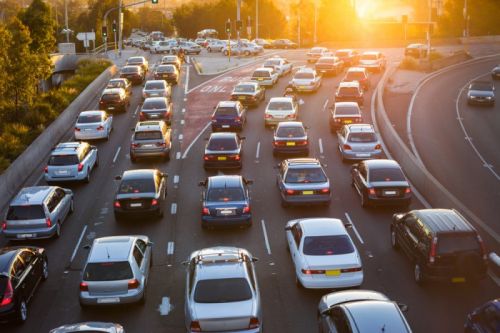
Everyday you are playing a self-portrait with your mobile phone, you must have imagined that someone has already used the camera function of the mobile phone to play a self-driving business. In the past two years, everyone has been staring at the "camera + artificial intelligence" game, which aims to improve the recognition rate of machine vision, improve the high-precision map and so on. In this article, let's take a look at the typical big companies and small companies that use "camera + artificial intelligence" to do things.
In the article "Don't argue about the future of artificial intelligence, someone has used it in the road repair" article, I introduced how Roadbotics uses mobile phone camera + artificial intelligence algorithm to improve road repair efficiency.
In an earlier article, we introduced a company called Lvl5:
The two buddies who were responsible for the Autopilot project in Tesla set up a company to set up Lvl5. Lvl5 works with Uber and Lyft teams to let drivers download an app. The app records GPS and cell phone gyroscope data while the video is being captured. After compression, the data is sent to the cloud. Lvl5 uses these data to improve high-precision maps.
Both Roadbotics and Lvl5 ​​have got what they want by tapping into the phone's own processing and data collection capabilities. The ultra-low threshold of "smartphone + car" allows people to collect road data, which is simply a crowdsourcing plan in the era of artificial intelligence.
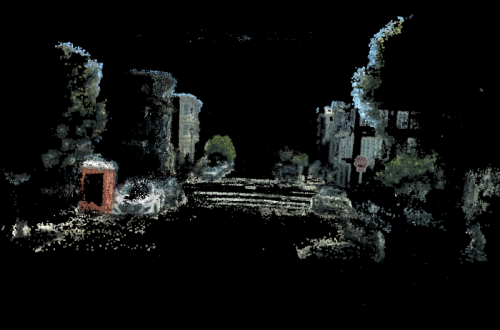
However, Lvl5 ​​is a bit more clear, because working with Uber and Lyft guarantees a sufficiently stable source of data. If you only rely on volunteers and ordinary users to collect data, it is basically not feasible. Because this app is undoubtedly a big power consumer, the phone will hang behind the windshield every time, and the user will uninstall the app after the user feels fresh. Only with the dedicated driver groups will there be a continuous and stable source of video.
In China, there are also companies that use similar ideas to play camera + artificial intelligence, such as the domestic ADAS company MINIEYE interviewed last year.
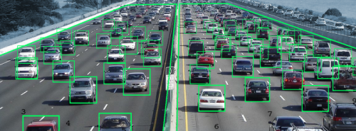
As early as 2013, MINIEYE cooperated with the teams all over the country to send the video taken by the vehicle back to the company, 10,000 kilometers per day. After getting the data, MINIEYE has improved its vehicle recognition rate through deep learning, and is now mature.
The above, just use the camera function of the third-party equipment to achieve the acquisition of the road data in front, the purpose is to collect road damage points, collect high-precision maps or to improve the ADAS system.
In fact, this is only a transition. The ultimate goal is to look at the "pre-installation."
In the era of intelligent networked cars, car cameras can scan all the roads, and the car itself has more powerful ability to collect data than mobile phones.
Tesla has taken the lead and explained to us what is the real "Intelligent Network" car. On May 7 this year, when Tesla pushed the second-generation Autopilot software update (version 17.17.4) to American car owners, I hope the owner agreed to take a small video and upload it to the Tesla server. Through these small videos, Tesla enhances the vehicle's ability to recognize lane lines, road signs and traffic lights.
Of course, 4G traffic consumption is also skyrocketing...
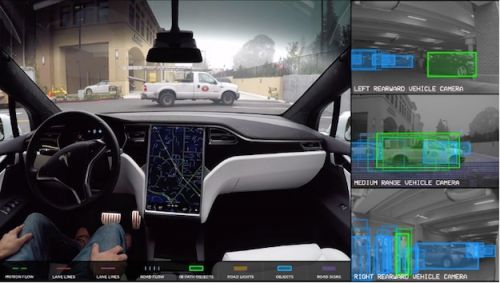
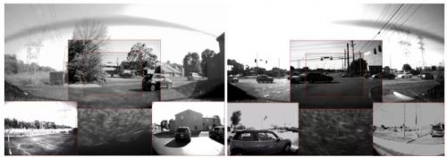
Dare to do this, can do this, and there is only Tesla. In fact, at the supplier level, everyone has already predicted that the car is the ultimate mobile terminal and has strong data collection capabilities.
At the 2016 CES, Mobileye released the Location Experience Management (REM) based on the front camera capture road sign. It is the first to propose a "crowdsourcing" model that uses front-mounted cameras mounted on civilian vehicles to collect road identification data and assist in high-precision map positioning.
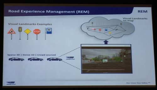
The ultimate goal of Mobileye in the field of maps is to build a high-precision map system covering the whole world with the major automakers and dealers.
So far, in terms of REM technology, Mobileye has already cooperated with companies such as Here, Japan Zenrin, Volkswagen, and BMW.
Coincidentally, in April of this year, Bosch also released its own “crowdsourcing plan†plan: BRS, Bosch Road Signature, partners including Baidu, Gaode and NavInfo, specifically targeting the Chinese road environment.
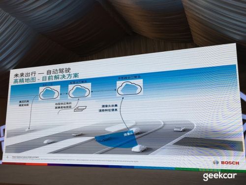
In the BRS system, the camera is responsible for collecting data such as lane lines, street signs and deceleration signs. The millimeter-wave radar is responsible for capturing road infrastructure such as barriers, utility poles, and bridges. Information captured by different vehicles will be uploaded to the cloud for overlay and calculation to generate a highly accurate map layer that can be located.
Simply put, Bosch BRS is an enhanced version of Mobileye REM, with more millimeter-wave radar data. In terms of maps, Baidu, Gaode and NavInfo's three peers can be united. It is obvious that everyone is highly convinced of the concept of “crowd-making†in the era of autonomous driving.
Only Tier 1 suppliers like Bosch have the ability to consolidate resources and get through a data channel from a camera to a radar to the cloud.
Whether it's using a mobile phone or a car camera, "crowd-for-money" seems to have a changing era, but before the data is sufficient, this new technology will not bring substantial improvements to autonomous driving technology. It may take another ten years for your car to become a map collector.
The reason for crowdsourcing is that the performance of mobile phones and car chips has become more powerful, which is enough to cope with map collection. Second, the era of automatic driving requires high-precision maps to assist the vehicle operation (with just the need, it has spawned the supply). ).
You will find that in the past two years, everyone basically thought of one piece, that is, using artificial intelligence + crowdsourcing ideas to train algorithms and improve map data.
Of course, the most happy is NVIDIA, because everyone has to buy chips to calculate.
By the way, are domestic entrepreneurs inspired?
Fiber Optic Rotary Joint, also known as optical fiber slip ring, optical fiber rotary joint, optical hinge, etc., is used to solve the problem of optical signal transmission between opposite rotating components, that is, to ensure that the transmission of optical signals is not interrupted due to rotation.
fiber optic rotary joint,fiber optic slip ring,optical rotary joint
Dongguan Oubaibo Technology Co., Ltd. , https://www.sliprobs.com